Skip to Content
  • Railway Land Housing Plans
  • Railway Land Housing Plans - 2

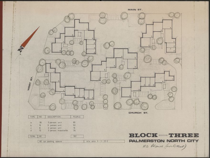
A plan for housing to be built in Palmerston North, on former railway land, bounded by Main Street, West Street and Church Street.

Identification

Object type
Multi-Page Document
Archive
Palmerston North City Council
Relation
PNCC7/6/31 Folder 1
Date
circa 1973
Digitisation ID
2018Pa_PNCC7-6-31F1_025248_002
Format
Paper
Held In
PNCC Archives

Related items

Railway Land Housing Plans - 2
Plan of Palmerston North Central Housing Scheme
Square Circular - October 2002
Residential And Industrial Development Map - 3
Residential And Industrial Development Map - 2
Residential And Industrial Development Map
Residential And Industrial Development Map - 5
Residential And Industrial Development Map - 7
Residential And Industrial Development Map - 4
Residential And Industrial Development Map - 6
Residential And Industrial Development Map - 9
Plans for the development of central Palmerston North - 5

Creation

Created By
Place
Railway Land, Palmerston North

Object rights

Taxonomy

Tags
city planning,
housing,
railway land,
Community Tags

Report a problem

Related items

Railway Land Housing Plans - 2
Plan of Palmerston North Central Housing Scheme
Square Circular - October 2002
Residential And Industrial Development Map - 3
Residential And Industrial Development Map - 2
Residential And Industrial Development Map
Residential And Industrial Development Map - 5
Residential And Industrial Development Map - 7
Residential And Industrial Development Map - 4
Residential And Industrial Development Map - 6
Residential And Industrial Development Map - 9
Plans for the development of central Palmerston North - 5